Trip Log – Day 172 – Los Osos, CA to San Luis Obispo, CA

Morro Bay to SLOOctober 24, 2015 – Sun, 70 degrees

Miles Today: 21

Miles to Date: 8,925

States to Date: 25

IMG_4909When you have an unavoidable day of administration work to set up travel plans for Santa Barbara and Los Angeles, it’s lucky to be in San Luis Obispo, where the Madonna Inn offers a midday diversion from reality. Although I visited Cal Poly’s campus and SLO’s vibrant downtown, the main event of this college town is the eclectic Madonna Inn, a three-dimensional confection that Alex Madonna constructed at the base of his very own mountain.

imagesThe urinal in the men’s room is so famous it’s impossible to use. Women are always barging in to take a peak.

images-4The cakes are also noteworthy. I had a piece of Toffee Crunch for lunch – it was a complete meal, except perhaps for its nutritional content.

images-3 images-1

images-2I didn’t get to see any of the 100+ unique rooms, but the lobbies and cafe were plenty garish for me. Besides, two hundred bucks a night and up is well beyond my taste. Instead, I stayed with a terrific friend-of-a-friend host whose house has a commanding view of the entire valley – including the Madonna Inn.

Posted in How Will We Live Tomorrow? | Leave a comment

Trip Log – Day 171 –Pacific Valley, CA to Los Osos, CA

Lucia to Morro BayOctober 23, 2015 – Sun, 70 degrees

Miles Today: 66

Miles to Date: 8,904

States to Date: 25

 IMG_4864Warmshowers superhost Murdock is a San Francisco 49’rs superfan, so even though the Seahawks trounced the 49’rs Thursday night, I still woke up more sports paraphernalia than I’ve even seen. Murdock lived up to his reputation by fueling me with waffles topped with ice cream and real maple syrup for breakfast. I pedaled mighty well on that combo.

IMG_4870

IMG_4877The first portion of my day was more Big Sur terrain – incredible hills cut into the coast with occasional exclusive estates hanging over the sea. At one vista a guy hovering on the guard rail exclaimed, “You never get tired of this.”  Which is true.  Watching the waves is mesmerizing and majestic.

IMG_4879The world leveled out into a broad coastal plane where the cycling was easy and the ocean gorgeous. Crowds of elephant seals sunned themselves on the sand, and a few splashed in the water.

IMG_4881 IMG_4883

IMG_4888I stopped in Cambria for lunch – the burrito at Sandy’s Deli is very good. South of town California One pulls away from shore, and the landscape reverts to California’s trademark bald brown hills.

I fell in love with the beach town Cayucos, and not just because it’s home of the Brown Sugar Butter Cookie, though that would be reason enough. Cayucos is funky and friendly and the air’s a perfect mix of sun and sea. Besides, the local church touts noteworthy messages.

IMG_4892 IMG_4890 IMG_4893

Morro Bay, just down the road, is larger and less charming. Highway One turns into a freeway and I felt the first surge of Southern California speed. Fortunately, I turned away from the highway to my host’s home in Los Osos and witnessed a dramatic sunset over the marshes.

IMG_4894

Posted in How Will We Live Tomorrow? | Leave a comment

Trip Log – Day 170 – Monterey, CA to Pacific Valley, CA

Monterey to LuciaOctober 22, 2015 – Sun, 70 degrees

Miles Today: 63

Miles to Date: 8,838

States to Date: 25

 The fabled ride down California Highway One south from Carmel through Big Sur is a captivating sequence of the sea meeting the land. There are silky beaches, shallow shoals, waves crashing against granite outcroppings and water spouting up sheer cliffs. I began the day beneath a carpet of clouds, pedaled through hours of bright sun, until misty fog rolled over the hills. The sea scent was strong. The sun’s heat was dissipated by thermal drafts and crosscurrents through the canyons. Giant hawks swooped and circled, playing on the tricky breeze. The road itself is gorgeous, a sinewy ribbon that weaves up and down cliffs. Elegant bridges span deep creeks. Highway One was built during the Depression; California’s first scenic highway. It’s still the best.

IMG_4822 IMG_4821 IMG_4825 IMG_4826

IMG_4832 IMG_4842

IMG_4828 IMG_4849 IMG_4852 IMG_4853

IMG_4860

Posted in How Will We Live Tomorrow? | Leave a comment

Trip Log – Day 169 –Santa Cruz, CA to Monterey, CA

Santa Cruz to MontereyOctober 21, 2015 – Sun, 70 degrees

Miles Today: 51

Miles to Date: 8,775

States to Date: 25 

IMG_4798Pedaling south along the cusp of Monterey Bay offers something for everyone. My day began with great coffee and chat with my Santa Cruz couchsurfing hosts about the state of the world. Before leaving town, I ate a healthy but pricey breakfast at Staff of Life’s community table, and then cycled side streets to avoid California 1 traffic.

IMG_4806Eventually I got on Alameda Road, which parallels the bay with lettuce, kale, and strawberry fields. It was strawberry harvest time, which is a labor-intensive activity. Crowds of Mexicans bent over the low plants, picked the fruit, and placed them directly into the plastic Driscoll’s containers we find in every supermarket. Perhaps the containers get rinsed somewhere along the line, but I will be extra diligent to wash them out of the box from now own.

IMG_4802 IMG_4800

Newly planted fields are wrapped in plastic sheathing that shimmers in the sun. Laborers walk each aisle and cut a circle in the plastic every foot or so to let the plants emerge. Additional laborers hand dig tranches along the ends of each row for irrigation. The crews are so large portable toilet trailers and taco vendors service the hardworking people.

I stopped in Watsonville for some excellent Mexican pastries. Unfortunately someone ripped my tire pump off Surly while I ate. I replaced it at the next bike shop, with one that actually works better. Still, it’s disheartening that people are compelled to damage and steal.

IMG_4810Moss Landing has a landmark power plant, incredibly cheap fruit stands, and really easy riding across the lowest portion of the bay.

The southern half of Monterey Bay has a dedicated bike path that follows the dunes and runs right into town. Cannery Row has been turned into condos and restaurants, but Monterey is still full of colorful looking characters that John Steinbeck could write about with flourish.

IMG_4815 IMG_4818 IMG_4817

I stayed with a group of four army officers studying non-violent methods at the Naval Institute. We ate steak and drank beer and chatted about the state of the world. There were more similarities than differences between my morning and evening hosts. Its a good omen for tomorrow when a military man states, “Non-violent action is twice as likely to succeed in it’s objective than violence.”

Posted in How Will We Live Tomorrow? | Leave a comment

Trip Log – Day 168 – San Jose, CA to Santa Cruz, CA

San Jose to Santa CruzOctober 20, 2015 – Sun, 75 degrees

Miles Today: 48

Miles to Date: 8,724

States to Date: 25

imagesThe ride from San Jose to Santa Cruz was both beautiful and shorter than I anticipated. That’s a winning combination. After a good breakfast with my super-fun warmshowers host family Meg, Dean, Dexter and Kylie, I climbed Los Gatos Canyon and around Jefferson Reservoir. I don’t even bother to take photos of near empty California reservoirs anymore; there’s no visual or news value in that. I had been warned about gravel and dirt sections, and so was prepared for a bit of slow going, but once on Old Santa Cruz Highway the pavement was super fine and the traffic was – what traffic? Cars here are stuck to their freeways, which are bumper-to-bumper until ten in the morning. My descent was speedy but not too steep. I arrived in Soquel by eleven and in Santa Cruz before noon.

Santa Cruz is a tricky place to define. Part honkytonk, part hippie-funk, part high-end retail. A place where Rocky Horror Picture Show and Steve Jobs – the Movie play at the same theater.

IMG_4788 IMG_4793 IMG_4791

After lunch along the dappled light of quant Main Street I decided to visit UC Santa Cruz. I’ve known several people who went to school there, and the campus plan was much discussed when I studied architecture forty years ago.

imgresToday, the fifty-year-old campus epitomizes both the good and the bad about 1960’s architecture and planning. For me, the problems outweigh the attributes. First, UCSC is miles from town. What is the point of being so far away? It’s a gas guzzling hassle to get there. Once on campus, immense fields separate students from any facsimile of real life, which was the point at the time but seems exclusive today.

images-2
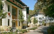
When you finally get there, it’s all long slung, asymmetrical buildings that are afraid to make a statement. The students reflect the detached nature of the place. While Berkeley and Stanford are crowded with Chinese and Indian students, the folks here are overwhelmingly white. To be sure, Berkeley and Stanford are too intense for their student’s wellness, but UCSC appears extreme in the opposite direction.

images-1

imgresNot everyone agreed with me when I met my couchsurfing host Scott and a bunch of his friends at Seabright Brewery for Neighborhood Night – nine-dollar pitchers and three-dollar tacos on Tuesday night. A bunch of us clustered around a few tables, some UCSC graduates, a few current graduate students, and several others who landed in Santa Cruz and decided to stay. It’s tough to make a living wage in this pricey town, but people bunk together and make a go of it because the engaging people, perfect climate and easy attitudes are worth a few inconveniences.

Posted in How Will We Live Tomorrow? | 2 Comments

Trip Log – Day 167 – San Jose, CA

San Jose to Palo AltoOctober 19, 2015 – Clouds and sun, 65 degrees

Miles Today: 38

Miles to Date: 8,676

States to Date: 25

More tootling around San Jose and talking with Silicon Valley folks. San Jose has a few lovely residential areas and several blocks of real downtown, but it never feels like a city just shy of a million people. San Jose actually has more residents than San Francisco. Just a precursor to the urban sprawl I will witness for miles in LA.

IMG_4772 IMG_4773 IMG_4774

Throughout Silicon Valley I’ve been warned more about my safety than in any other area of the country. People here are wary of the ongoing war between cyclists and motorists. The epicenter of the controversy is on Kings Mountain Road in the tony town of Woodside where cycle-haters have put tacks along this narrow, scenic road to blow out tires. Not just sprinkled them on the surface, but actually glued them point up to the pavement. Its on the news, wrongdoers are being sought, and lawsuits are threatened.

IMG_4779Locals don’t like the weekend cyclists and I imagine the cyclists may not be the most law-abiding of vehicles. But sabotage that could injure someone? We need perspective. I stay to designated trails and paved roads. I might get a blow-out or be struck by someone, but I doubt it would be purposeful. Around here, others disagree with my cheery perspective.

Posted in How Will We Live Tomorrow? | Leave a comment

Trip Log – Day 166 – Santa Clara, CA to San Jose, CA

San Jose to Palo AltoOctober 18, 2015 – Clouds, 65 degrees

Miles Today: 45

Miles to Date: 8,638

States to Date: 25

Welcome to my Silicon Valley Day. I was up early and off to a 7:30 a.m. breakfast meeting – on a Sunday – with Piaw Na software developer, cycling enthusiast and how-to book author. Piaw lives in a modest million-dollar house in Sunnyvale with synthetic grass, Mandarin speaking in-laws, and two young boys as American as any I’ve met.

imgres-1After a solid breakfast I headed up Foothills Expressway, one of the many cyclists in the weekend flow of pumping legs. They all passed me, of course, engineers on customized bikes with thin tires and competitive determination. I got to Stanford by noon and strolled the campus for an hour or so. Physically, Stanford is as much like Harvard as Silicon Valley is like Boston, which means they have nothing in common. Stanford is spread out and lush. I particularly liked the Rodin Garden next to the Art Museum, though the Gates of Hell are completely out of context in the bright California sun.

IMG_4762 IMG_4761 IMG_4765

On my way back to San Jose I passed many of the major headquarters. I visited the Googleplex and enjoyed my lunch sitting in the shade in a bright Adirondack chair at their secondary campus. I pedaled by Cisco and Linked-in, Samsung, Adobe, and Avaya. I even rode past Apple’s mammoth new Norman Foster Headquarters in Cupertino. I’d seen renderings but didn’t quite realize why the circular form was so fitting to what everyone says is the most secretive of Silicon Valley companies. It will be a glittering fortress set apart from the 1200 square foot 1960’s ranch houses across the street.

IMG_4768 imgres

From San Jose to Cupertino, Palo Alto, Mountain View, Sunnyvale and Santa Clara, Silicon Valley is a continuous, featureless environment of long slung buildings and immense freeways. People here are the maters of our electronic universe. They seem to have little interest in the physical reality around them.

Posted in How Will We Live Tomorrow? | Leave a comment

Trip Log – Day 165 – Berkeley, CA to Santa Clara, CA

Screen Shot 2015-10-18 at 11.02.39 AMOctober 17, 2015 – Clouds, 65 degrees

Miles Today: 73

Miles to Date: 8,593

States to Date: 25

I took off today without knowing where I was going – on purpose. I didn’t try to figure my route in advance, Instead, I decided to follow the San Francisco Bay Trail signs and see how well they directed me. The result included both high points and missteps.

IMG_4732The Berkeley Bike Bridge over I-80 took me to a nice stretch of path along the water, and led directly to the Port of Oakland. It might not be good riding during the week, but on a Saturday morning I was the only vehicle in this immense world of cranes and containers.

IMG_4736 IMG_4733 IMG_4734

I lost my way in Fruitvale and wound up back in Alameda; a lovely place but not on the way to anywhere. Finally, I righted myself and discovered the path through San Leandro. Much of the East Bay was salt flats which are being reclaimed as wetland. The bike path follows the barrier strip that separates the bay from the marsh. I met a group of birders who let me view birds loitering on old pier supports through powerful scopes.

IMG_4742 IMG_4741

IMG_4740I stayed on the route even when the path turned to gravel because it is so beautiful, but I was surprised how few people use it. I went for miles without seeing a soul. I did see one Mexican family building structures from driftwood and playing some invented game of cricket on the beach. The father said, “They wanted to go to Chucky Cheese, but I had a better idea.” They did appear to be having fun, and he saved fifty bucks.

Google maps routed me over the Route 84 bridge to Palo Alto, but bikes are not allowed on that toll bridge, so I stayed on the east side. After thirty miles of incredible riding I was dumped into suburbia through Hayward, Union City Fremont, and Newark. The area is simultaneously built up and empty. There were so few people about on a nice Saturday afternoon. I observed a few crowds at organized soccer games, and boot camp groups running around the many, many fitness centers; but miles of sidewalks lay vacant. Finally I saw students milling about outside Northwestern Polytechnic Institute. All Asian. In fact, ninety percent of the people I saw south of Oakland were Asian, both Indian and Chinese. Silicon Valley is an Eastern Brain Empire. The car dealers along the Auto Mile even advertise in multiple languages.

IMG_4746A series of bike paths led me around the southern tip of the bay. Again, trails on the crest of river levees. I missed a turn and wound up at the San Jose airport, but was able to find an alternate route that landed me at my host’s place in Santa Clara before dark set in. Nat and I enjoyed chili and salad and talk of semi-conductors and bicycles.

Posted in How Will We Live Tomorrow? | Leave a comment

Trip Log – Day 164 – San Francisco, CA to Berkeley, CA

SF to Pleasant HillOctober 16, 2015 – Sun, 70 degrees

Miles Today: 29

Miles to Date: 8,520

States to Date: 25


My final day of pin balling around the Bay Area and talking more than pedaling. Still, I managed to cover a fair amount of ground.

IMG_4709I climbed out of The Richmond District to the high end of Market Street to visit the LGBT Center. Then passed the opulent symphony, opera and City Hall as I descended Van Ness to the Fort Mason District to visit Stewart Brand’s Long Now Foundation.

IMG_4711Their view of the future – 10,000 years – is really out there. I skirted the waterfront back to Embarcadero and took the BART one last time across the bay and cycled out to Alameda, a totally cool island town just beyond Oakland, where I met with Michael Sturtz, Director of Stanford’s Creative Ignition Lab. If you don’t know exactly what that means, don’t worry. I think Michael his freethinkers are still figuring it out.

IMG_4719 images

Finally, I sped back up to Berkeley to stay with Lea Grundy, Chris Reiner and their family. We went to see The Martian, the first movie I’ve seen in my travels and an appropriate one considering my question.

Posted in How Will We Live Tomorrow? | Leave a comment

Trip Log – Day 163 – Pleasant Hill, CA to San Francisco, CA

SF to Pleasant HillOctober 15, 2015 – Sun, 70 degrees

Miles Today: 18

Miles to Date: 8,491

States to Date: 25 

IMG_4704Every so often, even cross-country cyclists need to deal with Activates of Daily Living. I spent most of my time today housekeeping: updating my bicycle accessories in person and arranging for some rehab work back home remotely. Still, my chores didn’t stop me from meeting interesting folks. Melissa Cistaro, author of Pieces of my Mother, shared a table with me at a busy Whole Foods for lunch. I also had a fascinating interview with Peter Shalek at Joyable, a start-up that provides Cognitive Behavior Therapy online.

imagesAfter spending a few hours reviewing inspection reports for the work back in Cambridge, I blew pent up energy with a ride through Golden Gate Park to see the sun set over the ocean before settling in with my warmshowers hosts in The Richmond neighborhood of northwest San Francisco. Heidi and Martin’s 1916 craftsman gem is one of the most comfortable homes I’ve ever visited: a perfect blend of formal and informal spaces; simple but elegant details; and graceful proportion.

IMG_4708

Posted in How Will We Live Tomorrow? | Leave a comment